Save Weeks With a 5 Minute Call: Site Plan for Permits for Homeowners
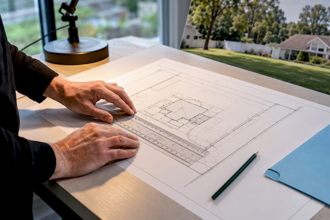
Most exterior projects, including decks, fences, sheds, and pools, require a site plan before a building department will issue a permit, and reviewers care most about setbacks, scale, parcel identification, and the footprint of proposed work. You have three realistic paths: sketch it yourself if your office accepts hand-drawn plans for small jobs, use online drafting software for fast and affordable results, or hire a licensed surveyor when your jurisdiction requires a stamped plan. Before you draw anything, call your local permit counter or pull up its checklist. That five-minute call saves weeks of resubmission.
TL;DR:
- Most permit reviewers focus on property lines, existing structures, setbacks, and proposed work drawn to scale, with clear labels and measurements.
- Using county GIS, aerial imagery, or prior surveys helps create accurate site plans, but larger projects or boundary disputes typically require a licensed surveyor with a stamped plan.
- Small residential projects may be approved based on simple hand sketches if local offices accept them, but detailed, scaled, and precisely labeled plans prevent delays.
- Submitting plans with missing or incorrect information, such as unlabeled setbacks, missing north arrows, or mismatched parcel numbers, often leads to rejection and resubmission delays.
- Pre-drawing your project on satellite maps or using online tools to establish accurate boundaries can save costs and time by reducing the risk of rejected plans and contractor delays.
Table of Contents
- The Permit-Ready Site Plan Checklist Reviewers Actually Use
- How to Draw a Site Plan for Permit Submission, Step by Step
- DIY Sketch, Software, or a Surveyor: Which One Do You Actually Need?
- Filing Tips That Keep Your Application Out of the Resubmission Pile
- What Actually Moves Applications Through Faster
- Skip the Guesswork: Draw Your Project Before You Draw the Plan
- Where to Verify Local Site Plan Rules
- Sources
- FAQ
The Permit-Ready Site Plan Checklist Reviewers Actually Use
A plan examiner scanning your submission isn’t judging your drafting skills. They’re running through a mental list, and if one item is missing, your application stalls. Here’s what that list looks like, drawn from municipal guidance used across the country.
Core identification items:
- Project address and legal description
- Assessor’s parcel number (APN) or tax lot ID
- North arrow oriented correctly on the page
- Written and graphic scale (both, not just one)
- Title block showing drafter name, date, and revision number
Site geometry every reviewer checks:
- Property lines with dimensions labeled to the nearest corner, not to a fence or hedge
- Existing building footprints with dimensions
- Proposed work drawn to scale, ideally in a different line weight or color from existing structures
- Numeric setback distances from each property line, not just dimension arrows without labels
- Distances between existing and proposed structures when relevant
Seattle’s permitting office publishes one of the clearer breakdowns of this, distinguishing a basic site plan from an “enhanced” one that adds critical-area review items. Its CAM 103 site plan guidance lists address, legal description, parcel number, north arrow, dimensioned property lines, structures, setback distances, and right-of-way information as baseline requirements, then layers on more for environmentally sensitive parcels.
Context and utility items:
- Easements and rights-of-way, labeled by type
- Adjacent street names
- Driveways, parking areas, and access points
- Utility connections, meters, and sewer or water line locations when the project affects them
Special-condition items, only when they apply:
- Trees and any required protection zones
- Contour lines or topography notes for sloped lots or grading work
- Stormwater features, if your jurisdiction requires drainage review
Portland’s development services office publishes a labeled sample plan that walks through roughly twenty distinct elements, from lot lines to utility easements, and it specifically calls out sheet size and scale requirements that many DIY submissions get wrong. A plan drawn on a scrap of printer paper at an arbitrary scale, even a technically accurate one, often bounces back simply because reviewers can’t measure it against the numbers you wrote down.
A gorgeous CAD file that nobody can read on a shared monitor does you no favors.
How to Draw a Site Plan for Permit Submission, Step by Step
You don’t need drafting software to get this right. You need a process. Here’s the order that keeps you from redrawing the whole sheet halfway through.
- Confirm what your office actually wants. Call the permit counter or check the jurisdiction’s published checklist. Some accept a neat hand sketch for a 6 foot fence; almost none accept one for a new accessory dwelling unit.
- Pull your records. Start with your deed, the county assessor’s parcel map, and county GIS if it’s available online. If a previous owner pulled permits, the permit archive often has an old survey or site plan you can build from.
- Verify your boundaries. Site Plan Creator notes that most residential submittals accept scaled drawings built from county GIS and aerial imagery, and only some jurisdictions insist on a licensed survey. Confirm which category your project falls into before you invest hours in a drawing.
- Measure in the field. Two people with a long tape beat one person with a laser measure for accuracy on an irregular lot. Note distances to permanent reference points, not to anything that could move, like a hedge or a shed.
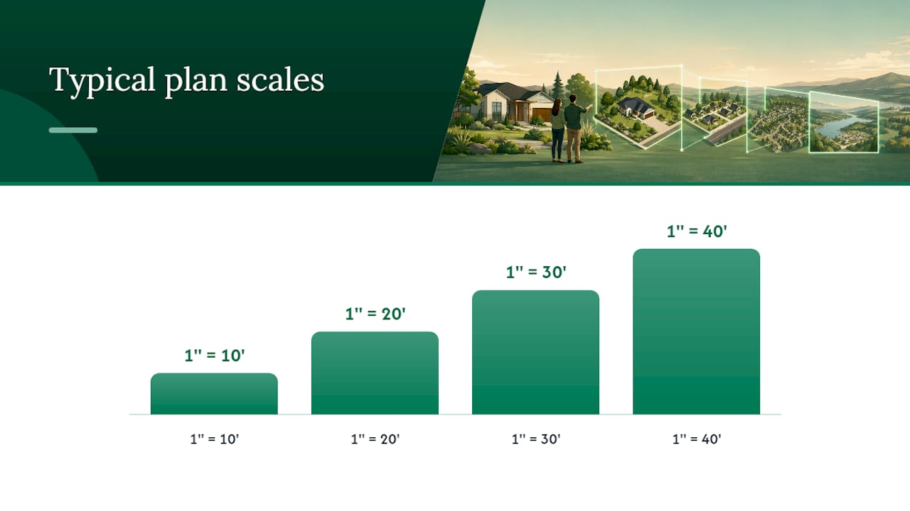
- Pick your scale and sheet size. For most residential lots, 1"=20’ or 1"=10’ works. Bigger lots or rural parcels sometimes need 1"=30’ or 1"=40’ to fit on a standard sheet. Always include a graphic scale bar, since photocopies and PDFs can shrink a printed scale note into meaninglessness.
- Draw in this order: property lines first, working from a known corner outward. Then existing structures, utilities, and major landscaping. Then your proposed work, in a visibly different line style so reviewers can tell new from existing at a glance. Label every setback as a number, not just a dimension line.
- Finish the sheet. Add your title block, north arrow, a simple legend, and a lot coverage calculation showing the math behind your numbers. Note your data source directly on the plan, something as simple as “Boundaries per county GIS; not a certified survey” tells the reviewer exactly what they’re looking at and what they’re not.
- Check it against the checklist one more time, line by line, before you submit. Confirm how many sets the office wants, whether they accept digital submittals, and what the current permit fee and review turnaround look like for your project type.
Pro Tip: Dimension every boundary line back to the nearest recorded property corner, never to a fence, wall, or planting bed. Fences drift over decades; recorded corners don’t, and reviewers know it.
Writing the source of your boundary data directly on the plan is a small habit that pays off disproportionately. A reviewer who sees “per county GIS” knows exactly how much confidence to place in your lines, and that transparency tends to move applications through faster than a plan that leaves the question open.
DIY Sketch, Software, or a Surveyor: Which One Do You Actually Need?
The right tool depends on project size, your local office’s tolerance for informal drawings, and how much a resubmission would cost you in delayed contractor schedules.
- DIY sketch: Free, and fine for very small projects like a short fence run or a small shed, but only if your permit office explicitly accepts hand drawings. The risk is resubmission, and every rejected plan adds a review cycle, often a week or more, back onto your timeline.
- Online drafting or browser-based site-plan software: Most residential projects fit here. PermitsGuide puts typical pricing for these services between $89 and $259, with delivery in 24 to 48 hours, and most plot boundaries using satellite and GIS data rather than a field survey. This is the sweet spot for decks, fences, sheds, patios, and similar work.
- Licensed surveyor with a stamped plan: Required when your jurisdiction explicitly demands certification, when there’s a boundary dispute, or when you’re adding significant new square footage. Expect survey costs to be higher and turnaround times to be longer than online drafting services.
- Architect or engineer: Necessary when the project needs structural calculations, grading and drainage engineering, or sealed construction documents, which is common for larger additions, retaining walls over a certain height, or anything touching stormwater systems.
Larger commercial or multi-unit projects live in a different category entirely. The City of Austin’s development services site plan requirements show how a bigger project often needs a cover sheet, an engineer’s summary, and additional reports like traffic analysis alongside the drawing itself.
Match your choice to the project: a fence or small deck rarely justifies a $400 survey, while a new structure near a property line, in a jurisdiction that requires certification, isn’t a place to gamble on a DIY sketch. If you’re weighing a deck project specifically, a deck permit cost calculator can help you see how plan requirements and rough costs interact before you commit to a drafting method.
Filing Tips That Keep Your Application Out of the Resubmission Pile
Submission mistakes are almost always the same handful of errors, and they’re avoidable once you know to look for them.
Format matters more than people expect. PDF is the preferred file type almost everywhere, sheet size should be 11x17 or larger for anything beyond the simplest project, and your scale needs to appear both as text and as a graphic bar, since digital scaling can distort a printed ratio.
The most common rejection triggers:
- Missing numeric setback labels, having dimension lines with no actual distance written on them
- No north arrow, or one that’s inconsistent with the drawing orientation
- A parcel number or APN that doesn’t match county records
- Text too small to read once the file is compressed or printed
- Easements left off the drawing entirely
Before you submit, run your plan against the jurisdiction’s own checklist item by item, and attach a short cover memo noting your data sources and any calculations, like lot coverage, that a reviewer would otherwise have to verify by hand. Pierce County’s site plan resources page makes the same point other counties repeat constantly: check the local checklist and call the counter with questions before you submit, not after you get a rejection notice.
Review timelines vary widely by project size and jurisdiction workload, so build in buffer time before scheduling contractors, especially for anything beyond a simple accessory structure. Ask the permit counter directly whether they require a stamped plan, what scales they’ll accept, and whether they take digital submittals, printed sets, or both.
What Actually Moves Applications Through Faster
Reviewers care more about a plan that’s complete and legible than one drawn in fancy software. A clearly dimensioned sheet with every setback labeled in numbers, not just lines, tends to clear review in one pass regardless of whether you made it in a $200 online tool or by hand with a ruler.
If you’re unsure whether your sketch will pass, spend the modest cost of a drafted plan or call the permit office directly. That small upfront cost almost always beats the time lost to a rejected application and a frustrated contractor waiting on a start date.
— Christian
Skip the Guesswork: Draw Your Project Before You Draw the Plan
There are online tools available that let you draw your fence, deck, pool, or concrete pad directly on a satellite view of your property and provide a site-specific estimate based on your actual dimensions rather than a generic price range.
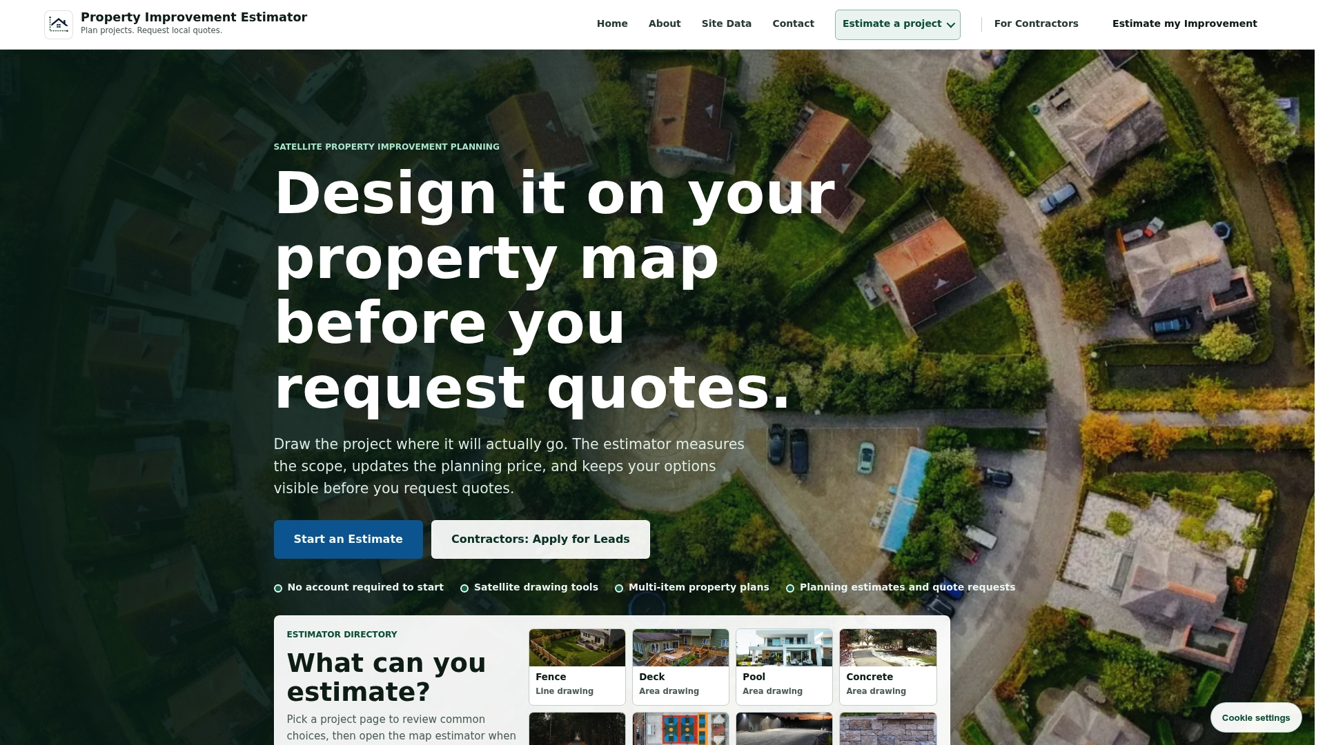
That matters for permitting because a plan built from precise measurements and clearly marked project boundaries gives contractors, and eventually your permit reviewer, a scope they can act on without a round of follow-up questions — you can see examples in the Ready Renovations gallery to understand what final plans and projects look like. You still confirm your local requirements with your permit office, but the Satellite Property Improvement Cost Estimator gets your project dimensions and layout locked in before you spend money on a drafted plan or a surveyor. Once your layout is set, you can request local contractor quotes, or if you’re planning a fence project specifically, request fence quotes directly from your prepared plan. Start by drawing your project on the map and see what a site-specific estimate looks like for your property.
Where to Verify Local Site Plan Rules
Every jurisdiction publishes its own checklist, and the differences between them are exactly why a five-minute phone call beats guessing. Seattle’s CAM 103 guidance, Portland’s sample site plan guide, and Austin’s site plan requirements page each show how much detail varies by city, from basic residential decks to full commercial submittals. Confirm your own office’s specific version before you finalize anything.
Sources
- Seattle Department of Construction & Inspections: CAM 103 — Site plan submittal guidance
- Portland Development Services: Drawing a site plan
- PermitsGuide: Site plan for a building permit — the complete guide
- City of Austin Development Services: Site plan requirements
FAQ
Can I Create My Own Site Plan?
Yes, for many small residential projects, as long as your permit office accepts hand-drawn or self-produced plans and you include the required elements: scale, north arrow, property lines with dimensions, and numeric setbacks. Larger projects or jurisdictions that require certification will need a licensed surveyor or stamped plan instead.
How Do I Draw Up Plans for a Permit?
Start from your property’s recorded boundaries, using county GIS, an assessor’s map, or a prior survey, draw existing structures and utilities, then add your proposed work in a distinct line style with every dimension and setback labeled numerically. Finish with a title block, north arrow, scale, and a lot coverage calculation before submitting.
How Do I Obtain a Site Plan for My Property?
You can draw one yourself using county records and field measurements, order one from an online drafting service for roughly $89 to $259 with 24 to 48 hour turnaround, or hire a licensed surveyor for a stamped plan when your jurisdiction requires it. A tool like Property Improvement Estimator can help you map out project dimensions on a satellite view before you commit to a drafting method.
Who Can Draw Up a Site Plan?
Homeowners can draw simple site plans themselves for small projects when local rules allow it. Larger, structurally complex, or boundary-sensitive projects typically require a licensed surveyor, architect, or engineer to produce a plan the permit office will accept.