How to Find Property Lines Before You Build, Fence, or Dig
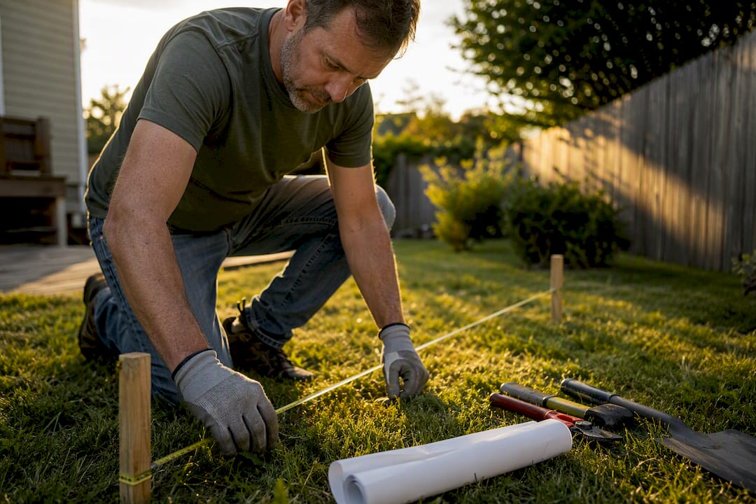
For a quick visual check, pull up your deed, plat map, or county GIS portal. For a boundary determination that holds up legally, hire a licensed land surveyor. Nothing else carries that weight in a dispute or a permit application.
Start with these two moves today:
- Search your county recorder’s or assessor’s GIS site by address or parcel ID to see your lot outline.
- Request your deed and plat from the county recorder if you don’t already have copies at home.
Before any digging to confirm a marker, call 811. County records and a licensed survey remain the two foundational documents homeowners should check first when a dispute or permit is on the line.
Key Takeaways
Locating a property line accurately requires layering deed and plat records, county GIS data, on-site markers, and a licensed survey when legal certainty matters.
| Point | Details |
|---|---|
| Start with documents | Pull your deed and plat map from the county recorder before checking anything online. |
| Use GIS as a first visual | County GIS portals beat consumer apps for a free preliminary boundary check. |
| Apps are approximate | Consumer parcel apps and Google Maps layers are useful for planning, not legal proof. |
| Surveys are binding | Only a licensed surveyor’s certified plat holds up in disputes or permitting. |
| Prep saves money | Gathering records, photos, and rough measurements can lower a surveyor’s time on site. |
Table of Contents
- Check Your Deed, Plat Map, and Legal Description First
- How Do You Find Property Boundaries Online?
- What Do Property Boundary Markers Look Like?
- When Do You Need a Licensed Land Surveyor?
- Preparing Before You Call a Surveyor or Contractor
- Turning Verified Boundaries Into an Accurate Project Plan
- What Actually Matters When You’re Trying to Find Your Lines
- Frequently Asked Questions
- Sources
Check Your Deed, Plat Map, and Legal Description First
Your deed contains the legal description of your parcel, and that description is the anchor for everything else. You can get a copy from the county recorder’s office or your title company, usually for a small fee or sometimes free if you pull it online. This is the same starting point most real estate professionals recommend before anyone touches a tape measure.
A plat map shows your lot and block within the larger subdivision, with dimensions for each side. County clerks and GIS portals both keep these on file, and matching the plat’s dimensions to visible features on your lot is how you start narrowing down where corners should sit.
Older properties sometimes use a metes-and-bounds description instead of a lot/block system. These read like a set of directions: a point of beginning (POB), then a bearing and distance for each boundary segment (“north 45 degrees east, 120 feet”). You don’t need a surveying degree to follow the logic, but translating bearings into actual ground positions accurately is where professionals earn their fee.
- Deed: request from the county recorder or your title company.
- Plat map: check the county clerk’s office or the online GIS portal.
- Metes-and-bounds: trace each bearing and distance from the point of beginning.
Zoning and permitting departments also keep plats and prior surveys on file, and they’ll often issue copies for a small administrative fee. That’s worth checking before you request anything through the recorder.
How Do You Find Property Boundaries Online?
County GIS or assessor portals are the best free online starting point. Search by address or parcel ID, and most counties will render your lot outline over an aerial photo within seconds.
- Search your county’s GIS or assessor site by address or parcel number to pull up the parcel outline.
- Cross-check that outline against Google Maps’ parcel layer as a quick secondary look, understanding it’s built for general reference, not precision.
- Try a consumer parcel or GPS mapping app if you want a mobile, on-site view, but treat the boundary line it draws as approximate.
County GIS data quality varies a lot from one county to the next. Some layers are pulled from recent, high-accuracy surveys; others are digitized from decades-old plats and aerial photos, so the underlying data can be outdated even when the map looks clean. Consumer apps like LandGlide cover most U.S. parcels and are genuinely useful for a fast visual reference, but consumer GPS accuracy falls well short of what a professional survey instrument delivers. None of these tools, including county GIS, are legal proof of where your line actually sits.
What Do Property Boundary Markers Look Like?
Physical markers are your best on-the-ground confirmation, but they take some hunting. Original survey pins are typically iron or rebar rods, often capped with a plastic or metal disk stamped with a surveyor’s license number, set near lot corners. Over the years they get buried under sod, bent by mowers, or covered in a few inches of settled soil.
- Check likely corner locations near curbs, driveways, and fence intersections first.
- Bring a metal detector and sweep slowly. This is a standard, non-destructive way to locate buried pins.
- Measure out from a known plat dimension to narrow your search area before you start sweeping.
- Sidewalk expansion joints and utility box placements sometimes align with old boundaries, but treat them as clues, not confirmation.
Pro Tip: If you find a pin, don’t pull it, straighten it, or move it, even if it looks wrong. Moving a monument can create a legal headache for you and your neighbor down the road. Note its location and leave it exactly as found.
When Do You Need a Licensed Land Surveyor?
A licensed surveyor is the only source that produces a legally binding boundary determination. If you’re settling a dispute with a neighbor, applying for certain permits, or building anything near a suspected line, this is the step that actually protects you.
The process generally follows a set path:
- Records research: the surveyor pulls your deed, prior surveys, and adjoining parcels’ records.
- Field measurement: using GPS-supported equipment and physical searches for existing monuments.
- Mapping and monumentation: setting or confirming corner pins and preparing a certified plat.
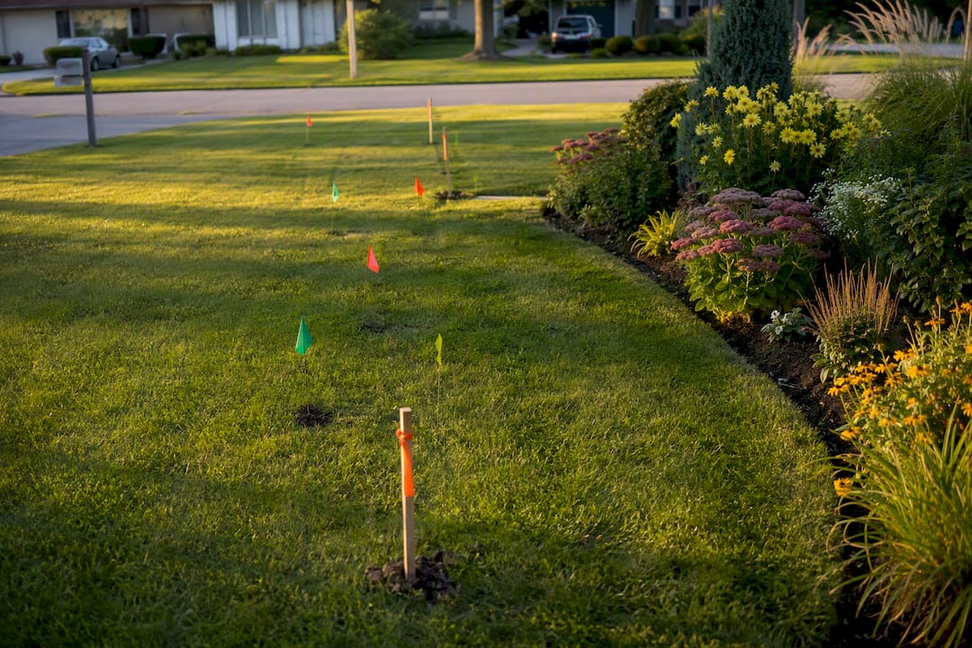
- Final deliverable: a stamped survey document you can file, and sometimes a physical stakeout marking corners with flags or stakes.
Cost swings widely based on lot size, terrain, how recently the parcel was surveyed, and whether existing monuments can be found or need to be re-established from scratch. If pins are missing but old survey records exist, ask about a targeted re-stake instead of a full retracement. It’s often significantly cheaper because the surveyor is confirming a known point rather than reconstructing the whole boundary.
Preparing Before You Call a Surveyor or Contractor
A little prep work can shave real time (and cost) off a surveyor’s visit. Here’s a simple checklist:
- Pull your deed and plat map together in one folder, digital or paper.
- Measure roughly from a fixed point, like your house corner, to where you believe the line runs.
- Note nearby landmarks: trees, fence posts, utility poles.
- Take photos of any suspected markers or corner areas.
- Drop a pin or log GPS coordinates on your phone at each point of interest.
A measuring wheel or long tape, a basic smartphone GPS app, and a metal detector cover most of what you need. None of these replace professional equipment, but they give a surveyor a head start. Always call 811 before digging anywhere near a suspected pin, and never move a marker even if you’re confident it’s misplaced. Write down what you find so whoever you hire isn’t starting from zero.
Turning Verified Boundaries Into an Accurate Project Plan
Once you know where your lines actually sit, the next question is what you can build inside them. That’s the gap Propertyimprovementestimator fills. The platform lets you draw fences, decks, pools, or lighting directly onto a satellite map of your property, using your parcel reference and plat dimensions as your guide for placement.
- Draw the project element (fence line, deck footprint, pool shape) onto your parcel outline.
- Get a site-specific estimate that reflects your actual dimensions and local costs.
- Send contractors a detailed scope package instead of a vague description, which speeds up accurate bidding.
This tool doesn’t replace a licensed survey. If your project sits near a suspected line or a permit requires certified boundaries, get that survey done first. What the platform handles well is everything after: turning a confirmed layout into a precise, buildable estimate you can hand to a contractor.
Homeowners who verify their boundaries before requesting quotes tend to get tighter, more accurate bids, because contractors aren’t guessing at setbacks or lot size.
Pro Tip: If you’re planning a fence, check your local setback rules before you draw the line. A residential fence permit guide can help you understand typical requirements before you commit to a layout.
Ready to see what your project actually costs? Try the satellite-based estimator once your boundaries are confirmed, and request quotes with a scope contractors can bid on precisely.
What Actually Matters When You’re Trying to Find Your Lines
Most guides on this topic bury the real hierarchy of trust under a pile of equally-weighted tips. It isn’t a hierarchy of preference, it’s a hierarchy of legal weight: deed and plat first, GIS and apps second, licensed survey when it counts. Treating a parcel app’s boundary line as equivalent to a surveyor’s stakeout is where homeowners get into trouble, usually right around the time a neighbor disputes a fence line they’ve already built.
The conventional advice oversells convenience. Apps and GIS layers are genuinely useful, and I’d never tell a homeowner to skip them. But they’re built for orientation, not adjudication. County GIS data itself is inconsistent from one jurisdiction to the next, some layers reflect a recent survey, others are digitized from a plat drawn decades ago.
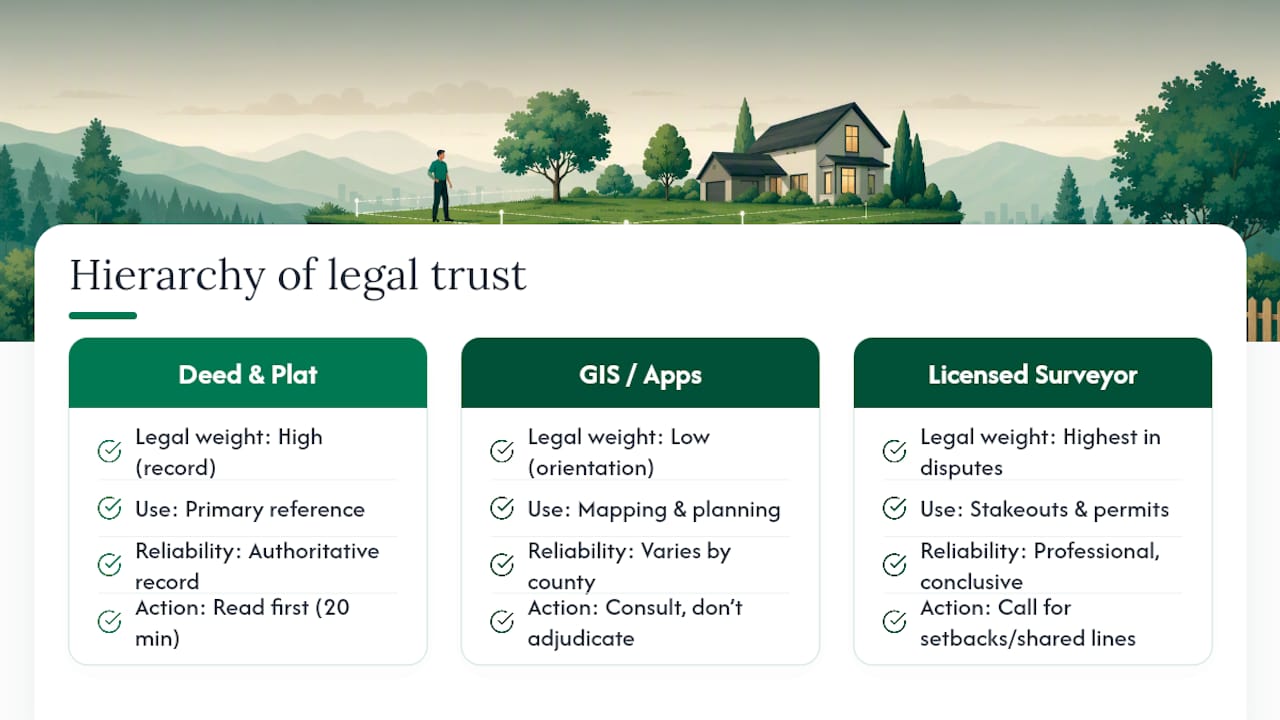
My honest take: spend twenty minutes with your deed and county GIS before you spend a dollar on anything else. If what you find lines up cleanly and nothing’s at stake legally, that’s often enough for planning purposes. If a project touches a setback, a shared line, or a permit, stop guessing and call a surveyor. The few hundred dollars you might save skipping one is nothing compared to what a misplaced fence costs to move.
Frequently Asked Questions
How can I find my property lines for free?
Check your county assessor or GIS portal, which usually renders your parcel outline over an aerial map at no cost. Your deed and plat map, if you already have copies, are also free references you likely already own.
Are online parcel maps accurate enough to build a fence?
They’re accurate enough for rough planning, but not for final placement. County GIS layers can be outdated, and consumer apps carry real margin for error, so confirm with a survey before anything permanent goes near a line.
What’s the difference between a property line and an easement?
Your property line marks legal ownership boundaries, while an easement grants someone else (a utility company, a neighbor) the right to use part of your land for a specific purpose, even though you still own it. Both should appear on your deed or plat, and setbacks are a separate zoning restriction that limits how close you can build to either.
Do I need a survey to settle a boundary dispute with a neighbor?
Yes, if the disagreement is serious enough to need resolution. A licensed surveyor’s determination is the only version that holds up if the dispute goes further, since deeds, plats, and apps are informational rather than legally conclusive.
How much does a property line survey typically cost?
Cost depends heavily on lot size, terrain, and whether existing monuments can be found. If markers are missing but records exist, ask your surveyor about a targeted re-stake, which is often cheaper than a full boundary retracement.
Sources
- How to find property lines: Fast, easy, and precise - Redfin
- How to find property lines - This Old House
- How land surveyors help resolve boundary disputes - McKissock