Avoid Costly Strikes: The 8 811 Marking Colors Homeowners Must Know

Utility locators mark underground lines using the APWA uniform color code, the same eight colors used nationwide: white for your proposed dig area, pink for survey marks, red for electric, yellow for gas and petroleum lines, orange for communications, blue for water, green for sewer, and purple for reclaimed water or irrigation. Crews apply these as paint, flags, or stakes after you call 811, and once they’re down, you leave them alone until you’ve confirmed it’s safe to dig.
TL;DR:
- Markings in red indicate electric lines, which must always be treated as live until confirmed safe by a professional.
- Blue and purple marks both relate to water, but purple signals reclaimed water or irrigation lines, often distinguishable by nearby sprinkler systems.
- Pre-mark your entire dig area in white before calling 811 to speed up utility responses and reduce the risk of damage.
- Marks are typically valid for several weeks, but verification with local authorities is necessary if the project extends beyond that period.
- Ignoring or improperly handling colored utility marks can result in fines, service disruptions, or dangerous accidents, emphasizing the importance of following proper procedures.
Table of Contents
- The 811 Marking Colors and What Each One Warns You About
- How Crews Apply and Space Their Markings
- Before and After You Call 811: A Step-by-Step Checklist
- Why These Colors Carry Legal Weight, Not Just Convenience
- Mapping Your Dig Area So Locators and Contractors Both Get It Right
- Our Take on the Safest Way to Plan a Dig
- Map Your Dig Area Before You Call
- Sources
The 811 Marking Colors and What Each One Warns You About
Every color on the ground has one job: telling you what’s buried underneath before your shovel or excavator gets there. Texas811 uses the same standardized color key that nearly every one-call center in the country follows, because the whole system only works if a red flag means the same thing in Boise as it does in St. George.
Here’s the full breakdown:
- White marks the boundary of your proposed excavation. You paint or flag this yourself before you call, so locators know exactly where to look.
- Pink flags temporary survey markers, usually property lines or grade stakes, not utilities at all.
- Red means electric power lines, cables, conduit, or lighting circuits. Treat every red mark as live until a professional says otherwise.
- Yellow covers gas, oil, steam, and other petroleum or gaseous materials. This is the color that should make you slow down the most.
- Orange identifies communications lines, including fiber optic cable, telephone, and cable TV conduit.
- Blue signals potable water lines, the pipes feeding your home’s tap.
- Green marks sewer and drain lines.
- Purple flags reclaimed water, irrigation systems, or slurry lines, increasingly common in areas with drip irrigation or gray-water reuse.
The two colors people mix up most often are blue and purple, since both relate to water. If you see a mark and can’t tell which it is, look for a nearby irrigation head, sprinkler valve, or drip line. That’s usually your tell that you’re looking at purple, not blue. When in doubt, don’t guess. Call the operator listed on the flag or check with your local 811 center before you touch anything near it.
How Crews Apply and Space Their Markings
Locators use paint, flags, stakes, or thin wire “whiskers” depending on the ground surface and how long the mark needs to last. Paint is common on grass or pavement, while flags and stakes work better in loose soil or gravel where paint won’t hold up.
Most marks run about a foot to a foot and a half long, spaced every few feet along the line’s path so you can trace its direction across your yard. When two or more utilities share a trench, crews often mark them side by side in their respective colors, sometimes adding a company initial or logo so you know which operator to call if there’s a question. If the actual surface over a line has been removed or altered, locators may offset the mark slightly to one side. That offset is intentional. It’s telling you where the facility runs, not necessarily the exact spot to dig.
Before and After You Call 811: A Step-by-Step Checklist
Getting an accurate locate starts before the call. Here’s the order that actually works:
- Pre-mark your dig area in white using paint, flags, or stakes so locators know exactly where to focus. PG&E’s marking guidance recommends this step specifically because it narrows the search area and speeds up the response.
- Call 811 at least two business days before digging, which is the typical notice window most one-call centers require, though local rules vary.
- Wait for confirmation that all affected utilities have responded before breaking ground, even if some marks appear early.
- Leave every mark in place once locators finish. Don’t mow over them, wash them off, or move stakes to “clean up” the yard.
- Use hand tools only inside the tolerance zone near any marked line, and switch to mechanized equipment once you’re clearly outside that zone.
- Contact the operator directly if a mark looks faded, contradicts another mark, or is simply missing where you expected one.
Pro Tip: If snow or frost is covering your yard, some centers accept black marking as a substitute for white pre-marks, since white paint disappears against snow. Check with your local center before assuming this applies.
Marks are generally valid for several weeks, though that period varies depending on your operator and local regulations, so check locally before your project extends.
Why These Colors Carry Legal Weight, Not Just Convenience
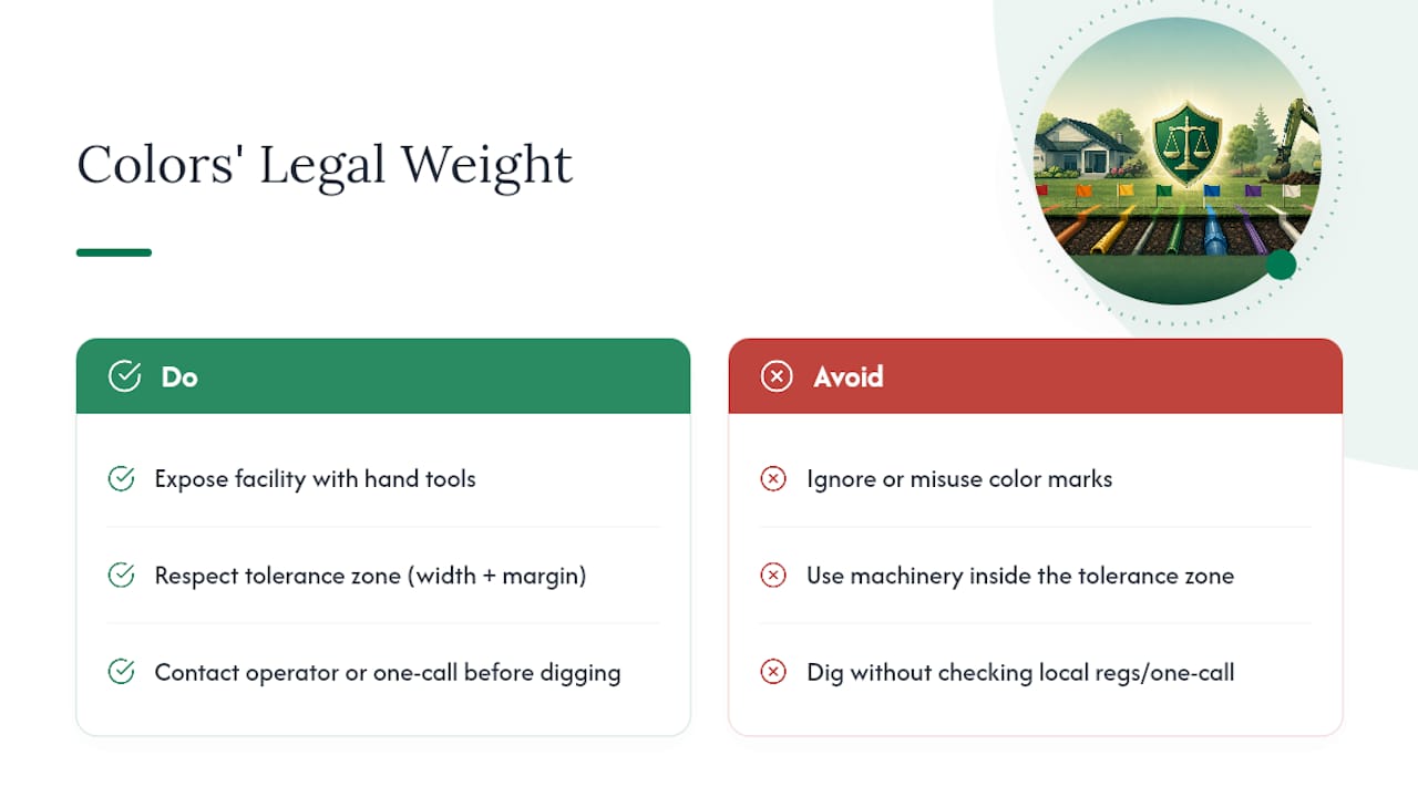
The tolerance zone is the buffer around a marked line where you’re required to expose the facility using hand tools or other non-invasive methods instead of machinery. Without a specific local width on the books, the industry standard set by APWA’s uniform marking guide recommends the tolerance zone include the facility’s width plus some margin on each side.
Many states write APWA’s color code directly into their excavation regulations, which means a yellow flag in your yard isn’t just a courtesy. It’s a legal marker, and Oregon’s dig-safely program notes that misusing or ignoring these colors can carry fines. Striking a gas or electric line does more than rack up repair bills. It can shut down utility service to your whole block and put you or a contractor in the hospital. If anything about a mark seems off, contact the operator or your one-call center before you dig, not after.
Mapping Your Dig Area So Locators and Contractors Both Get It Right
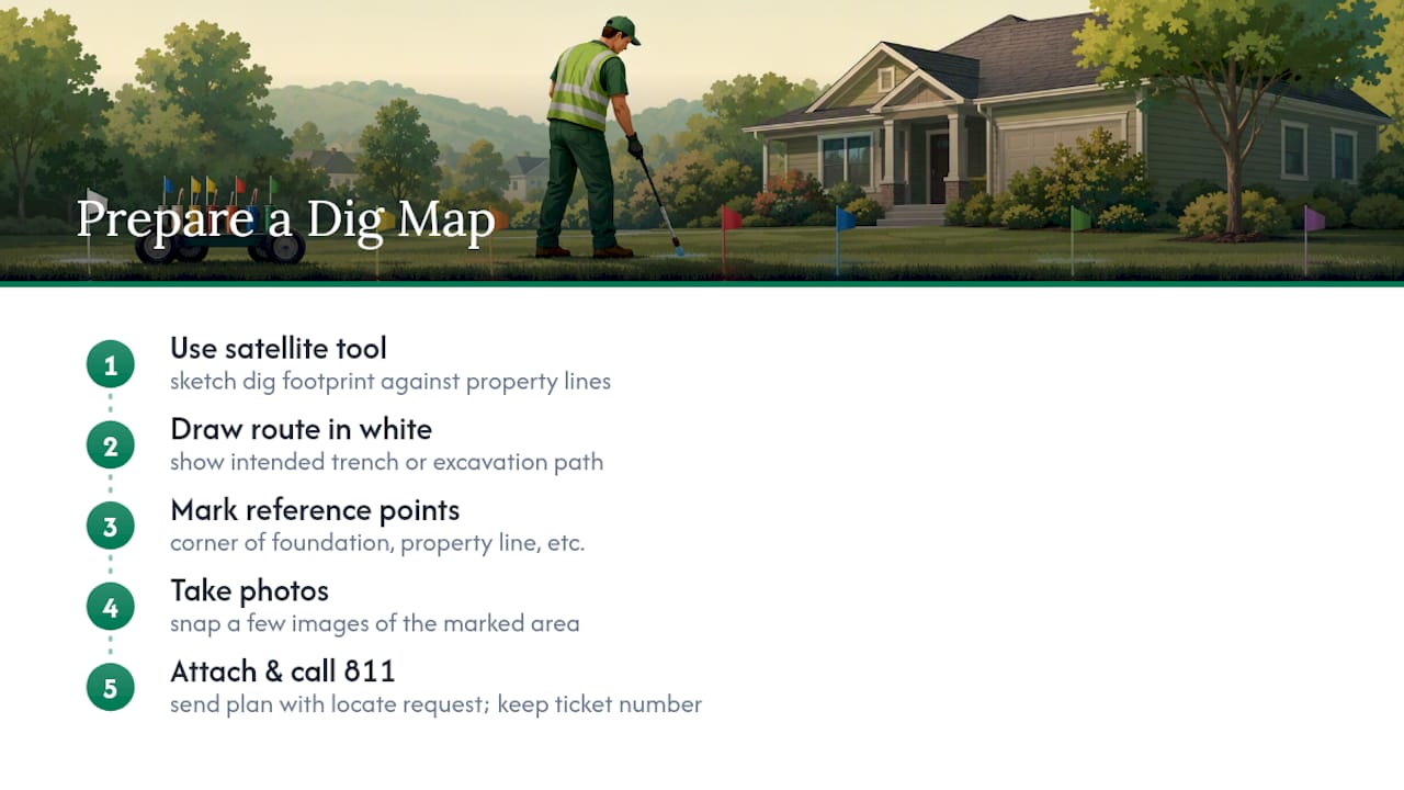
A clear plan attached to your locate request cuts down guesswork on site and often improves how precisely lines get marked. Draw your intended route in white, note fixed reference points like the corner of your foundation or a property line, snap a few photos, and hang onto your ticket number for the whole project.
A satellite-based mapping tool makes this easier to put together and share, since it lets you sketch the dig footprint against your actual property lines instead of a rough hand-drawn sketch. That’s not a substitute for calling 811 or for the operator’s own locate, just a way to hand locators and contractors a plan that’s easier to read at a glance.
Our Take on the Safest Way to Plan a Dig
The workflow that actually prevents problems is simple: pre-mark in white, call 811, wait for confirmed marks, then expose lines carefully with hand tools inside the tolerance zone. Most damage claims trace back to skipping one of those steps, usually the wait period, not to some rare marking error. Treat every colored flag as a fact, not a suggestion, and build your project timeline around it rather than the other way around.
— Christian
Map Your Dig Area Before You Call
Knowing what red, yellow, and blue mean on your lawn only gets you halfway there. The other half is showing locators and contractors exactly where you plan to build, so the marks that come back actually match your project instead of a rough guess at where your fence or deck line runs.

A satellite-based mapping tool lets you draw your fence, deck, pool, or lighting layout directly on a satellite map of your property, with real measurements instead of a sketch on the back of an envelope. That map becomes a shareable plan you can attach to your locate request or hand straight to a contractor, helping clarify dimensions and property lines. If you’re planning a fence that requires postholes, you can start a free estimate and export the plan before your 811 call goes in, or use it afterward to request local fence quotes that already reflect your exact layout.
Sources
For the full color code and marking guidelines, Missouri 811’s resource page mirrors the same APWA standard used nationwide, as does the Tenn811 uniform color code page. Local rules on notice windows and tolerance zones vary by state, so confirm the specifics with your own one-call center before you dig. If you’re planning excavation for a pool, this excavation overview walks through additional locating considerations specific to larger digs.
- 811 Utility Color Code Guide | Underground Marking Colors
- PG&E markings brochure
- What Do the Markings Mean? - Okie 811